A fully functional, turn-by-turn directions feature was beyond our budget, but there are ways to access and use data in our web map to help you reach and explore new parts of the Miami Valley Trails. Follow the steps below on either a desktop PC or a mobile device to make best use of these resources. For this example, let's say you want to experience the Great Miami River Trail in Miami County and you want to start your day in Tipp City. Here's how to use the web map to find a parking area to start your journey:
1. Pull up the Miami Valley Trails web map.
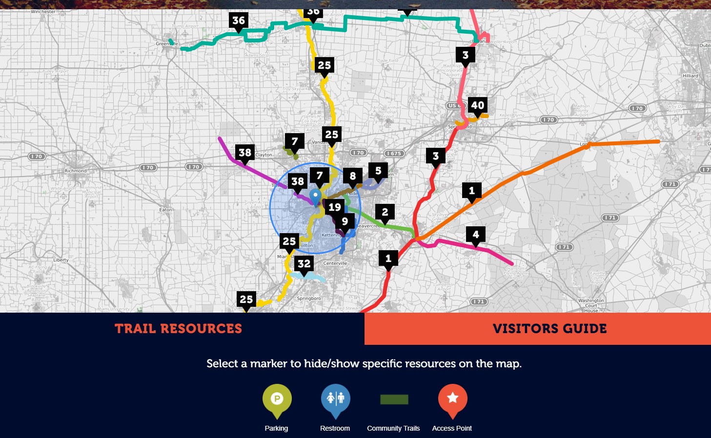
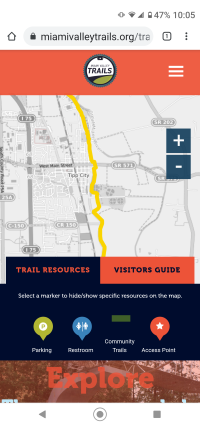
2. Locate the four toggles below the map for Parking, Restroom, Community Trails, and Access Points.

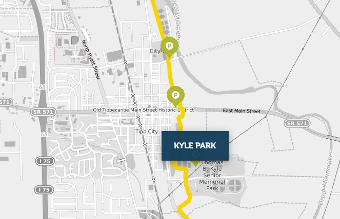
3. When you click on the "Parking" symbol, green pins will appear on the web map. Use the plus/minus symbols, or your fingers on a touch screen to zoom in on Tipp City:
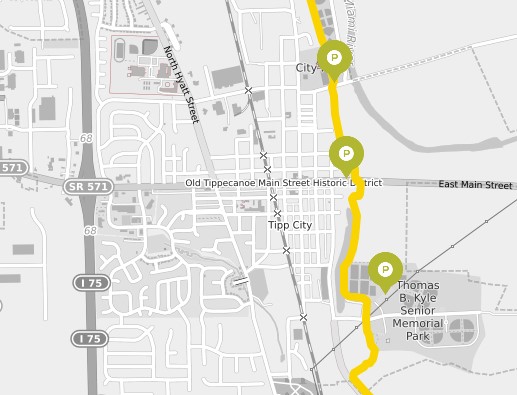
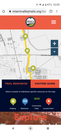
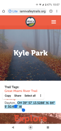
4. Now click on one of the Parking locations' green pin. In this example, you have selected Kyle Park:
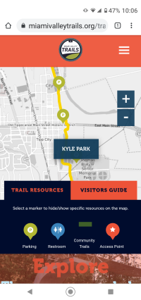
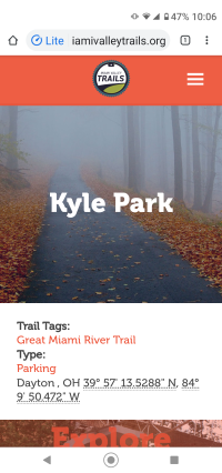
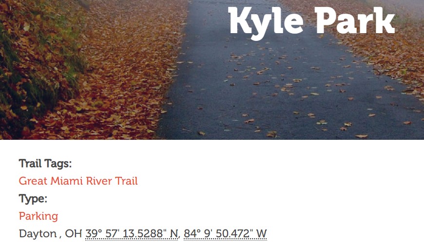
5. Next, click on the blue box that says "Kyle Park." This will open a page that provides GPS coordinates for the selected location:
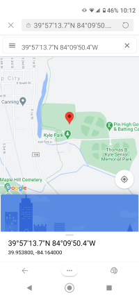
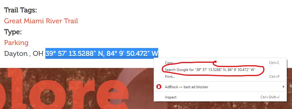
6. Those coordinates can be transferred by "copy-paste" to your preferred map and directions web site. We have confirmed that coordinates in this format work for Google Maps, Bing Maps, and Open Street Map. A "right-click" may create a quick shortcut for searching for those coordinates:
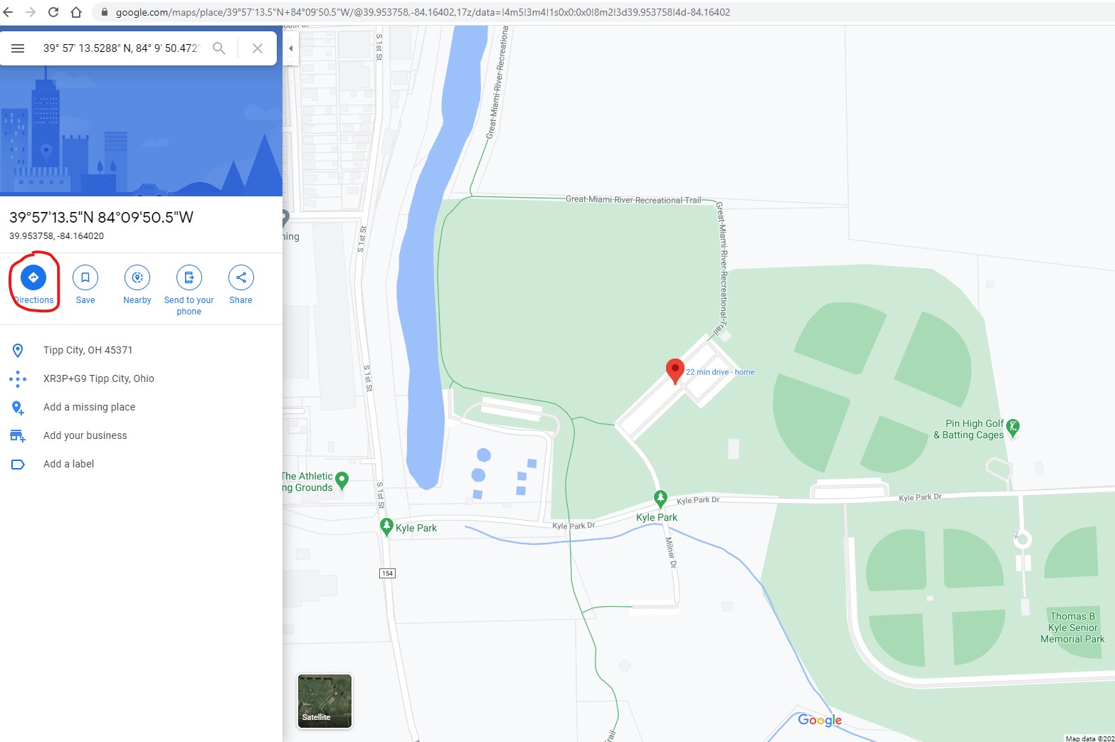
7. With the point selected, your preferred Map and Directions web site can provide you the directions you need to get your Miami Valley Trail experience off to a good start.
We hope this helps! These same steps can be used to locate restrooms and other access points along the Miami Valley Trails.
Let us know if you encounter any issues with these steps, or our instructions, by filling out our "Contact Us" form.
Below are images of these same steps as performed on a mobile (Android) smart phone.